
Maps
Share Maps on Facebook
Share Maps on X (formerly Twitter)
Share Maps on Linkedin
Email Maps link
If you are viewing this website on a mobile device, please use full-screen mode (landscape). |
To view interactive versions of the maps below, please click HERE.
The maps are for illustrative purposes only. The use of land outside of the Oro Valley town limits is subject to the requirements of the governing entity.
 |  | |
| Land Use Map A map showing the proposed general land uses in Oro Valley. It is the official Oro Valley policy on how land is distributed or set aside for commercial, residential, parks, open space, and other uses. | Public Facilities Map A map of public facilities, such as police and fire stations, schools, government buildings, libraries, and more. | |
 | 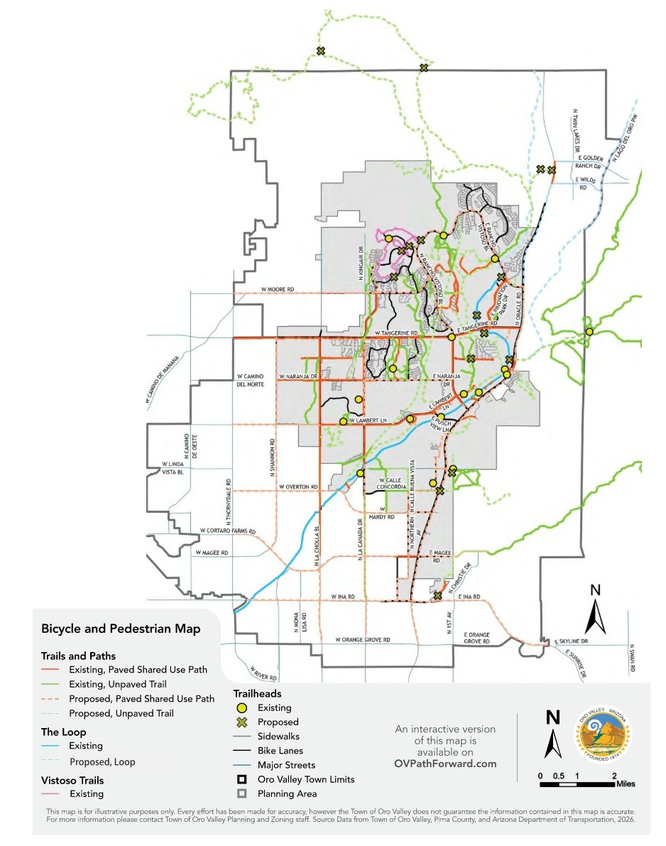 | |
| Parks and Recreation Map A map of Oro Valley’s parks and recreation facilities, including open space systems. | Bicycle and Pedestrian Map A map showing existing and proposed bike and pedestrian routes. | |
 | ||
| Circulation Map A map showing the roads, including their classifications, in and around Oro Valley. | A map of transit routes in and around Oro Valley. | |
Page last updated: 27 Apr 2026, 12:51 PM

Who's Listening
-
Call or email us

Phone (520)-229-4800 Email OVPathForward@orovalleyaz.gov